Okanagan Falls BC - Wall Map
Thompson Okanagan BC
Couldn't load pickup availability
Scale & Dimensions
Scale & Dimensions
Map Scale: Created at
Note: In case of multiple options, the actual map scale will vary depending on the wall map size you choose.
Dimensions: 3 Options Available
Area Covered
Area Covered
This map includes
Map Features
Map Features
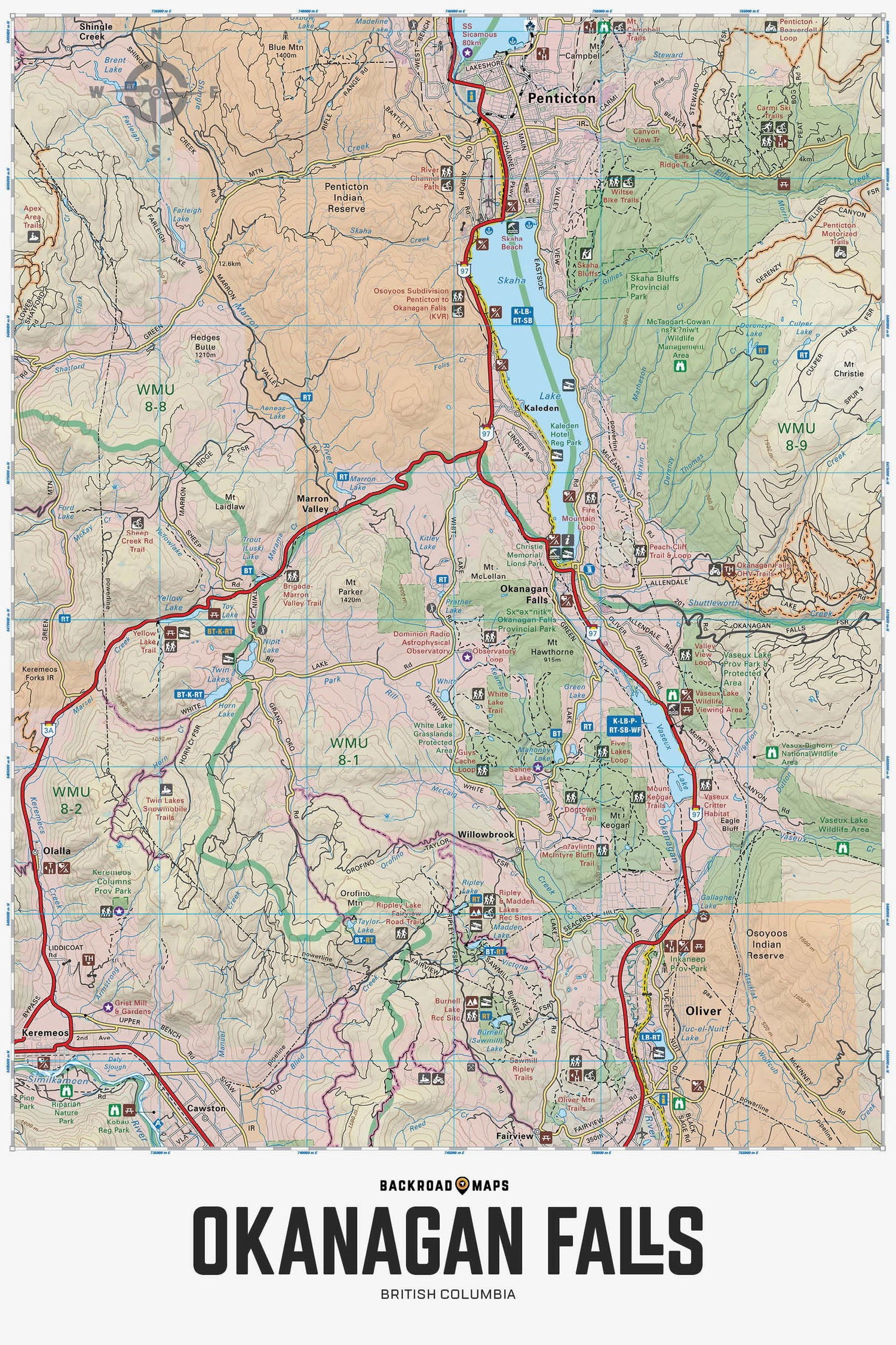
Covering Okanagan Falls , Oliver and Penticton, this British Columbia topographic recreation map highlights all the access roads and trails, recreation sites and campgrounds, trails for hiking, horseback riding, mountain biking, cross-country skiing and snowshoeing, fishing rivers and lakes, viewpoints, waterfalls and more! Printed at 1:50,000 scale, this map features our industry-leading topographic contours and relief shading. Included on the map are Okanagan Falls, Oliver, Penticton, Cawston, Fairview, Kaleden, Marron Valley, Skaha Lake, Vaseux Lake, Willowbrook, Green Lake, Mahoney Lake, Inkaneep Park, Okanagan River, Ripley Lake, Tuguluit Lake, White Lake, Yellow Lake and more!
The Wall Map Format
The Wall Map version of this map features a minimal layout to display nicely to fit into common picture frame sizes so you can hang it on the cabin, home or workshop wall.
All maps come printed on waterproof synthetic material for extra durability.

