Murtle Lake - Wells Gray Provincial Park BC - Wall Map
Thompson Okanagan BC
Couldn't load pickup availability
Scale & Dimensions
Scale & Dimensions
Map Scale: Created at
Note: In case of multiple options, the actual map scale will vary depending on the wall map size you choose.
Dimensions: 3 Options Available
Area Covered
Area Covered
This map includes
Map Features
Map Features

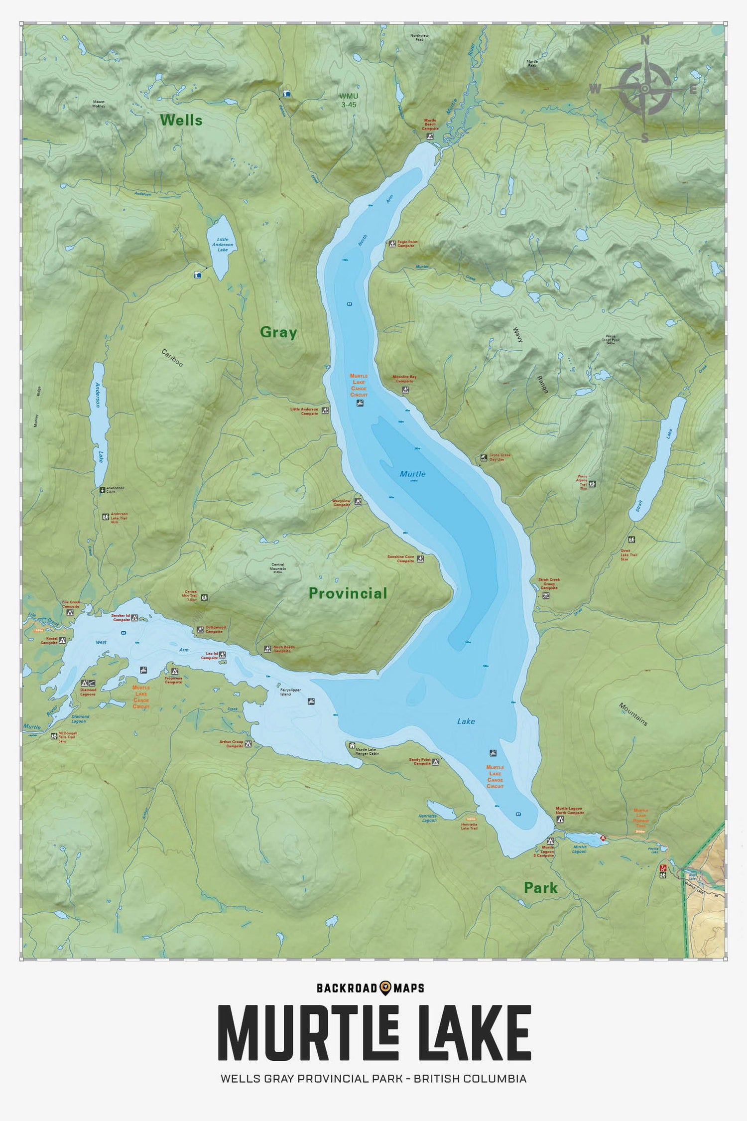
Highlighting the Murtle Lake area of Wells Gray Provincial Park British Columbia, this map features the canoe routes and access points, campsites, cabins, portage trails with distance markers, fish species, hiking trails and waterfalls. This Adventure map can be used for fishing, camping, exploring, canoeing, kayaking, wildlife viewing and more! With 1:10,000 water and road data and covering 2,715 sq. km (1,050 sq. mi), this map includes Murtle Lake, Wells Gray Provincial Park, Anderson Lake, Blue River, Diamond Lagoon, Henrietta Lake, McDougall Falls, Murtle River and more!
The Wall Map Format
The Wall Map version of this map features a minimal layout to display nicely to fit into common picture frame sizes so you can hang it on the cabin, home or workshop wall.
All maps come printed on waterproof synthetic material for extra durability.

