Mount Robson Provincial Park BC - Wall Map
Canadian Rockies
Couldn't load pickup availability
Scale & Dimensions
Scale & Dimensions
Map Scale: Created at
Note: In case of multiple options, the actual map scale will vary depending on the wall map size you choose.
Dimensions: 3 Options Available
Area Covered
Area Covered
This map includes
Map Features
Map Features
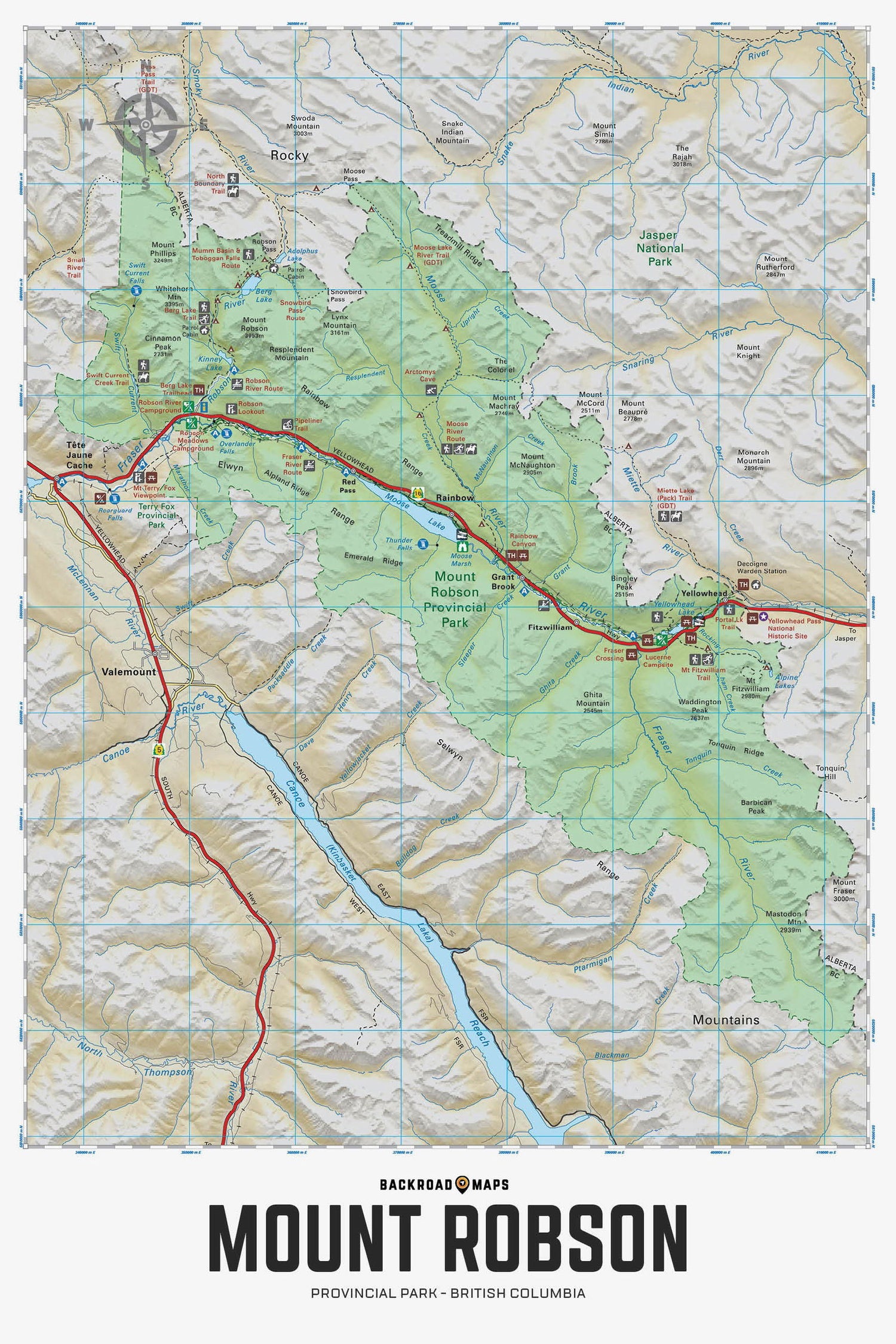
Providing a detailed overview of Mount Robson Provincial Park in BC, this recreation map highlights all the main roads and trails, campgrounds and backcountry campsites, trailheads and notable recreation areas, historic sites and viewpoints, larger lakes and river systems, paddling routes and more! Shown at 1:150,000 scale, this map features topographic relief shading. Included on the map are Berg Lake, Fraser River, Kinney Lake, Moose Lake, Moose River, Mount Fitzwilliam, Rainbow Canyon, Robson River, Snowbird Pass, Swiftcurrent Creek, Yellowhead Lake and more!
The Wall Map Format
The Wall Map version of this map features a minimal layout to display nicely to fit into common picture frame sizes so you can hang it on the cabin, home or workshop wall.
All maps come printed on waterproof synthetic material for extra durability.

