Marble Canyon - Kootenay National Park BC - Wall Map
Canadian Rockies
Couldn't load pickup availability
Scale & Dimensions
Scale & Dimensions
Map Scale: Created at
Note: In case of multiple options, the actual map scale will vary depending on the wall map size you choose.
Dimensions: 3 Options Available
Area Covered
Area Covered
This map includes
Map Features
Map Features

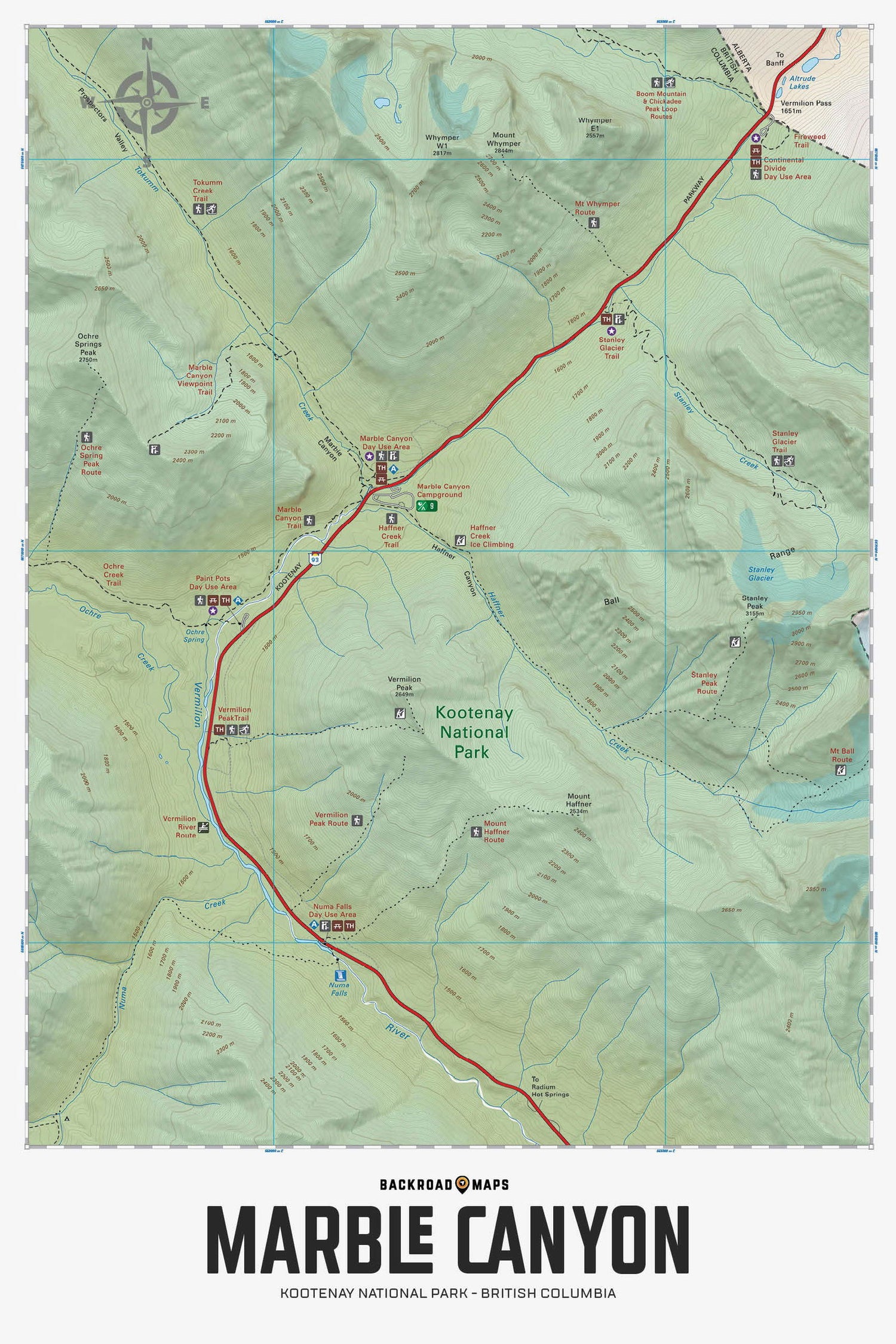
Focusing on the Marble Canyon area of Kootenay National Park, this Adventure topographic map shows you all the access roads, trails for hiking, snowshoeing and cross-country skiing, paddling routes for canoeing and kayaking, picnic sites, campgrounds, viewpoints, backcountry campsites, waterfalls and more! No other recreation map provides you with this much detail for the Marble Canyon area. Shown at 1:50,000 scale, this map features our industry-leading topographic contours and relief shading. Included on the map are Marble Canyon, Kootenay Parkway, Haffner Creek, Numa Falls, Mount Haffner, Mount Whymper, Ochre Creek, Stanley Glacier, Tokumm Creek, Vermillion Peak, Vermillion River and more!
The Wall Map Format
The Wall Map version of this map features a minimal layout to display nicely to fit into common picture frame sizes so you can hang it on the cabin, home or workshop wall.
All maps come printed on waterproof synthetic material for extra durability.

