Lake O'Hara - Yoho National Park BC - Wall Map
Canadian Rockies
Couldn't load pickup availability
Scale & Dimensions
Scale & Dimensions
Map Scale: Created at
Note: In case of multiple options, the actual map scale will vary depending on the wall map size you choose.
Dimensions: 3 Options Available
Area Covered
Area Covered
This map includes
Map Features
Map Features
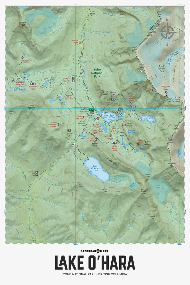
Focusing on the Lake O'Hara area of Yoho National Park British Columbia, this topographic map highlights all the backcountry huts and cabins, campgrounds, trails for hiking, horseback riding, mountain biking, cross-country skiing and snowshoeing, fishing lakes, rock climbing areas, viewpoints, waterfalls and more! This Adventure map features our industry-leading topographic contours and relief shading and includes the areas surrounding Lake O'Hara, Abbot Pass Hut, Cathedral Lakes, Elizabeth Parker Hut, Lake McArthur, Lake O'Hara Lodge, Lake Oesa, Linda Lake, Mary Lake, Morning Glory Lakes, Opabin Plateau, Park Mountain, Seven Veil Falls, Vera Lake, Victoria Falls and more!
The Wall Map Format
The Wall Map version of this map features a minimal layout to display nicely to fit into common picture frame sizes so you can hang it on the cabin, home or workshop wall.
All maps come printed on waterproof synthetic material for extra durability.