British Columbia – VERSION 2025
Release date: November 2024
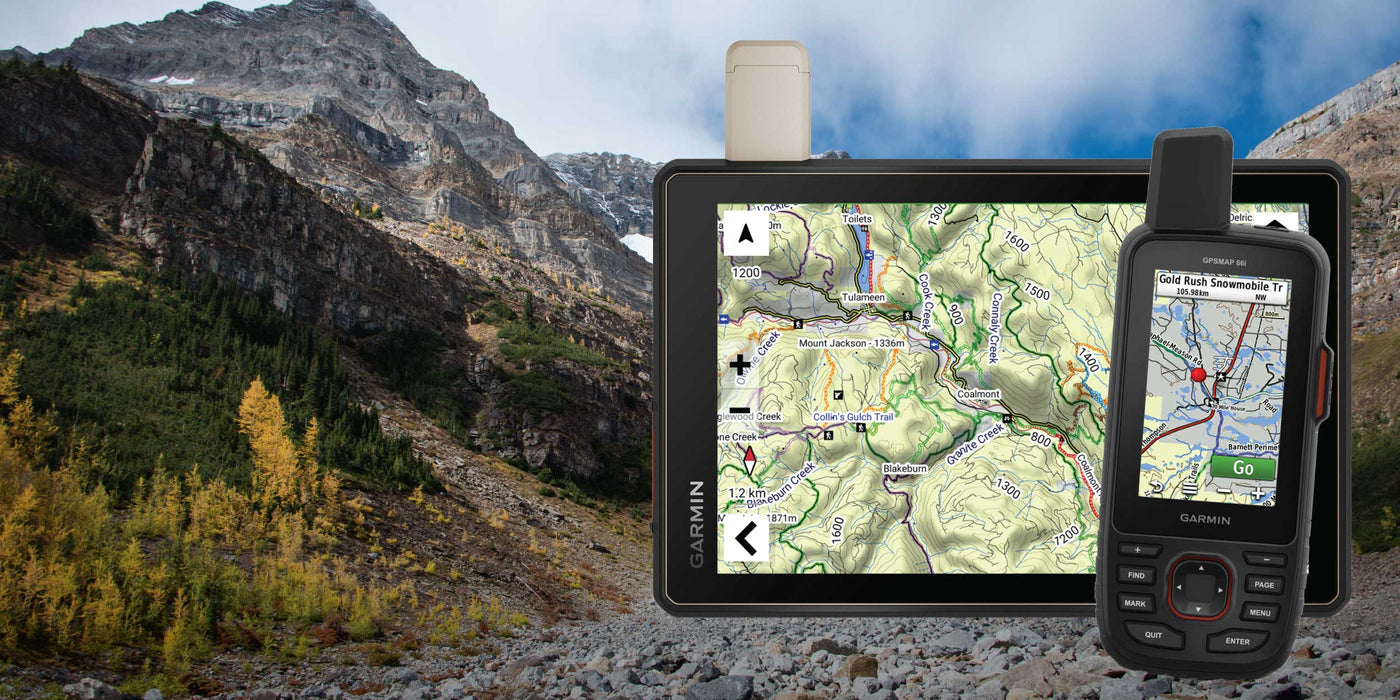
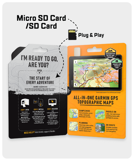
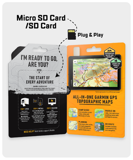
Shop GPS Maps Update your Maps
General
- Enhanced Road
- Enhanced ATV, Snowmobile, Multi-use Trail, Paddling and TCT data
- New Dirtbike
- New Docks
- New Fish Spawning
- New Overland Routes
- New Ranger Stations
- New Shipwrecks
Roads
- Added 2000+ km of roads
- Added almost 900 new road names (added over 750 named non-route roads)
Trails
- Added 4,000+ km of trails (ATV, multi-use & snowmobile) including 300+ new Trailheads and Staging Areas
Oil & Gas
- Added 337,700+ Resource Sites
- New Pipeline Corridor Areas
- New Resource Facilities Footprints
Recreation & Geographic POI
Added over 5,500 new recreation & geographic features
- 1,150+ new Waterfalls
- 1,330+ BC Marine Trails
- 630+ Transportation Services
- 500+ Backroad Attractions
- 460+ New National / Provincial / Regional / Natural Urban Parks
- 300+ Private Campsites
- 230+ new Multi-use Trails
- 130+ Lodging, Resorts & Outfitters
- 280+ New Access, Paddling Routes, Docks, Boat Launches, and Marinas
- Close to 65 new Overlander Routes
- Close to 80 new Winter Recreation Areas
- 50 new ATV Trailheads and Staging Areas
- 30 new Fishing Lakes, Rivers, Streams
- 9 new Gun Ranges
- 80+ Fish Spawning
- 30+ new Snowmobile Routes and Staging Areas
- Close to 30 new Dirtbike areas
- 25+ Shipwrecks Locations
- 24 New Diving sites
British Columbia – VERSION 2023
Release Date: August 2023
General
- Enhanced Road and Creek names
- Enhanced Golf Course data
- New Regional district borders
- New Ski Area
- New EV Charging Stations
- New Diving Sites
- New Ghost Towns
- New Gun Ranges
- New Private Campsites
Roads
- Added almost 220 new road names (added over 400 named non-route roads)
Trails
- Added 4,000+ km of trails (ATV, multi-use & snowmobile) including 400+ new Trailheads and Staging Areas
Recreation & Geographic POI
Added over 31,000 new recreation & geographic features
- 29,000+ new Rivers and Creeks
- 1,200+ new EV Charging and Gas Stations
- Close to 300 new Trailheads
- 175+ new Private Campgrounds
- 100+ new National / Provincial / Regional / Urban Parks
- Close to 100 new Golf Courses
- Close to 80 new Beach Accesses
- 30 new ATV Trailheads and Staging Areas
- Close to 100 new Backroad Attractions
- 35 new Ghost Towns
- Close to 20 new Gun Ranges
- Close to 40 new Paddling Routes and Marinas
- 20+ new Snowmobile Routes and Staging Areas
- Close to 30 new Winter Recreation Areas
British Columbia – VERSION 2022
Release Date: August 2022
- Refined the routable and non-routable road networks
- Added over 16,000 kilometres of roads
- Added almost 21,000 new road names
- Enhanced existing road names
- Updated the ATV, Multi-Use Trail & Snowmobile Trail systems with over 4,775 kilometres of new Trails
- New Overlander Routes and Points of Interest added
- Over 100 new ATV Trailheads
- Enhanced Water Polygons names
- Updated Private and Leased Land
- Added new Beach Areas
- Added/Updated over 4,000 Adventure/recreational, geographic and water, and public service points.
- Added Points of Interest for Mountain Summits, Retailers, Gas Stations, Pullout & Rest Areas, and Lakes
- Added over 650 new Fishing Lakes, Streams, and Rivers
- Added over 50 new Backroad Attractions
- Added over 1,730 new Transportation Services including 1,165 new Gas Stations
- Enhanced Creek names and added or named over 675 new Water Features
- Refined Urban area features
British Columbia – VERSION 2021
Release Date August 2021
- Refined the routable and non-routable road networks
- Updated the ATV, Multi-Use Trail, Paddling Route & Snowmobile trail systems
- Added over 2,180 km of ATV trails
- Added 350 km of Paddling Routes
- Modified the Multi-Use Trail & Snowmobile trail systems
- Added over 160 BC Rockfish Conservation Areas
- Added/Updated over 4,000 Adventure/recreational, geographic and water, and public service points.
- Enhanced the Park Points of Interest adding area and a new easier to see green and white symbol
- Updated and enhanced Fishing Points of Interest including adding area, maximum depth and elevation to several hundred points
- Updated and enhanced Hunting Points of Interest including adding or modifying species such as big game, game birds and other species to most hunting areas
- Updated and enhanced Paddling Points of Interest including adding difficulty, River Grade and Class, Portage Length to hundreds of points
- Updated and enhanced the Canadian Rockies, Thompson Okanagan, Vancouver Coast and Vancouver Island area Adventure Points of Interest
- Significant modification to road, trail and other lines for better viewing
- Modified fishing, hunting and park boundary lines and areas for better viewing
- Refined Urban area features
Vancouver Island British Columbia – VERSION 2021
Release Date August 2021
- Refined the routable and non-routable road networks
- Updated the ATV, Multi-Use Trail, Paddling Route & Snowmobile trail systems
- Added almost 1,750 km of ATV trails
- Added 145 BC Rockfish Conservation Areas
- Updated and enhanced the Vancouver Island area Adventure Points of Interest
- Added almost 900 Adventure/recreational, geographic and water, and public service points.
- Enhanced the Park Points of Interest adding area and a new easier to see green and white symbol
- Updated and enhanced Fishing Points of Interest including adding area, maximum depth and elevation to several hundred points
- Updated and enhanced Hunting Points of Interest including adding or modifying species such as big game, game birds and other species to most hunting areas
- Updated and enhanced Paddling Points of Interest including adding difficulty, River Grade and Class, Portage Length to hundreds of points
- Significant modification to road, trail and other lines for better viewing
- Modified fishing, hunting and park boundary lines and areas for better viewing
- Refined Urban area features
British Columbia – VERSION 2020
Release Date August 2020
- Now includes Night Mode
- Enhanced Crown Land visibility through updated colouring
- Addition of over 560 Limited Entry Hunting areas for BC
- Refined the routable and non-routable road networks
- Added over 1,500 km to the ATV, Multi-Use Trail, Paddling Route & Snowmobile trail systems
- Addition of over 2,200 points including our recreational, geographic and water, and public service points of interest. This includes the following additions to our Adventure POI:
- 240 Backroad Attractions
- 279 Fishing Lakes, Rivers & Streams
- 564 Hunting LEH Areas
- 70 Paddling Points (Access, Paddling Routes & Portages)
- 138 Parks (Provincial, Regional & Urban)
- 74 Trails (Multi-Use Trails)
Vancouver Island British Columbia – VERSION 2020
Release Date August 2020
- Now includes Night Mode
- Enhanced Crown Land visibility through updated colouring
- Addition of over 50 Limited Entry Hunting areas for BC
- Refined the routable and non-routable road networks
- Added over 1,900 km to the ATV, Multi-Use Trail, Paddling Route & Snowmobile trail systems
- Addition of 640 points including our recreational, geographic and water, and public service points of interest. This includes the following additions to our Adventure POI:
- 30 Backroad Attractions
- 138 Fishing Lakes, Rivers & Streams
- 51 Hunting LEH Areas
- 70 Paddling Points (Access, Paddling Routes & Portages)
- 143 Parks (Provincial, Regional & Urban)
- 60 Trails (Multi-Use Trails)
British Columbia – VERSION 2019
Release Date July 2019
- Enhanced our Routable Roads with 23,000+ km of improvements to our Forest Service Road network, including adding road names and upgrading non-routable roads to routable
- Added 4,450+ km of motorized trails for ATV’s and Snowmobiles including close to 125 new trailheads and staging areas
- Added close to 1,500+ km of Multi-Use Trails including the Trans Canada Trail with 350+ new trailheads
- Updated the Great Divide Trail extending from Montana to Kakwa Wildland Park
- Added close to 400 km of new Paddling Routes including 80+ new access and portage locations
- Added close to 200 new Provincial, National and Urban Parks including close to 130 new Campsites, Huts/Shelters and Day Use/Picnic Areas
- Enhanced close to 1,600 new First Nations Reservations
- Added close to 125 new Public Beach Access locations
- Added close to 50 new Wildlife Viewing points of interest including Scenic Areas and Fire Towers
- Added close to 75 new Backroad Attractions including historical sites and points of interest
- Added close to 20 new Waterfalls
- Added 15 new Winter Recreation adventures for cross-country skiing and snowshoeing
- Added thousands of mile markers along Railway Corridors
- Updated the Motorized Vehicle Closures Areas in BC to show Mountain Caribou Wildlife Recovery Areas
- Enhanced the Snowmobile Route cartography for improved display
Vancouver Island British Columbia – VERSION 2019
Release Date July 2019
- Enhanced our Routable Roads with 450+ km of improvements to our Forest Service Road network, including adding road names and upgrading non-routable roads to routable
- Added 90 km of Multi-Use Trails including the Trans Canada Trail with 110+ new trailheads
- Added close to 170 km of new Paddling Routes
- Added 150+ km of new motorized trails for ATV’s and Snowmobiles including 2 new trailheads and staging areas
- Enhanced 440 new First Nations Reservations
- Added 120+ new Public Beach Access locations
- Added close to 50 new Provincial, National and Urban Parks including 3 new Day Use/Picnic Areas
- Added close to 10 new Wildlife Viewing locations including Scenic Areas
- Added close to 5 new Backroad Attractions including historical sites and points of interest
- Added close to 5 new Waterfalls
- Added thousands of mile markers along Railway Corridors
- Enhanced the Snowmobile Route cartography for improved display
British Columbia – VERSION 8.0
Release Date April, 2018
- Enhanced the Thompson-Okanagan, Kootenay Rockies, Vancouver Coast and Vancouver Island areas parks and adventures
- Updated BC Private Leased Lands
- Added 22,750+ km of improvements to our backroad network
- Added close to 4,000 km of Multi-Use Trails including the Trans Canada Trail with close to 830 new trailheads
- Added 2,000+ km of Motorized Trails for ATV’s and Snowmobiles including close to 100 new trailheads and staging areas
- Added close to 675 km of new Paddling Routes including 750+ new Canoe Campsites and Day Use areas
- Added 700+ new Provincial, National and Urban Parks including close to 70 new Campsites and Huts/Shelters
- Added close to 500 new Fishing Lakes, River and Streams including 120+ new Boat Launches and Marinas
- Added 300+ new Wildlife Viewing points of interest including Scenic Areas and Fire Towers
- Added 300+ new Public Services
- Added 100+ new Backroad Attractions including historical sites and points of interest
- Added 70 new Recreation Sites
- Added 70 new Waterfalls
- Added close to 60 new Lighthouses
- Added 20+ new Winter Recreation adventures for cross-country skiing and snowshoeing
- Enhanced cartography for improved display of Parks, Conservation Areas, Crown Lands, creeks and activity points of interest on GPS units
Vancouver Island British Columbia – VERSION 8.0
Release Date April, 2018
- Improved BC Private Leased Lands
- Added close to 19,275 km of improvements to our backroad network
- Added 1,400+ km of Multi-Use Trails including the Trans Canada Trail with 375+ new trailheads
- Added 420+ km of new Paddling routes including 600+ new Canoe Campsites and Day Use areas, Paddling Access and Portage locations
- Added 270 km of new Motorized Trails for ATV’s and Snowmobiles including 5 new trailheads and staging areas
- Added 350+ new Provincial, National and Urban Parks including 20 new Campsites and Huts/Shelters
- Added close to 60 new Wildlife Viewing locations including Scenic Areas
- Added close to 50 new Backroad Attractions including historical sites and points of interest
- Added 40+ new Lighthouses
- Added 30 new Fishing Lakes, Rivers and Streams
- Added 25+ new Recreation Sites
- Added close to 20 new Waterfalls
- Added 5 new Winter Recreation adventures for cross-country skiing and snowshoeing
- Added close to 5 new Visitor Information locations
- Enhanced cartography for improved display of Parks, Conservation Areas, Crown Lands, creeks and activity points of interest on GPS units
British Columbia – VERSION 7.0
Release Date November 2016
- New addition of Lake Bathymetry depth contours for 1,800+ fishing lakes, rivers and streams.
- New addition of private leased lands for hunters and anglers.
- New mountain biking and cross-country ski trail networks.
- Close to 8,000 KM of additional paddling routes. Includes 100+ additional paddling routes and access locations.
- 5,000+ KM of additional multi-use, mountain biking, cross-country ski and Trans-Canada Trails. Includes 800+ additional trailheads.
- 4,000+ KM of additional motorized trails for ATV-OHVs and Snowmobiles. Includes 180+ additional trailheads and staging areas.
- Close to 200 additional fishing lakes, rivers and streams with stocking and species information. Includes 150+ additional boat launches and marinas.
- Close to 200 additional national, provincial and urban parks. Includes 500+ additional campsites, day-use/picnic areas, backcountry/canoe campsites, recreation sites and huts in major parks and recreation areas.
- Close to 150 additional wildlife viewing areas.
- Close to 75 additional winter recreation activities.
Vancouver Island British Columbia – VERSION 7.0
Release Date November 2016
- New addition of Lake Bathymetry depth contours for close to 400 fishing lakes, rivers and streams.
- New addition of private leased lands for hunters and anglers.
- New mountain biking and cross-country ski trail networks.
- 3,000+ KM of additional paddling routes. Includes 45 additional paddling routes and access locations.
- 2,000+ KM of additional multi-use, mountain biking, cross-country ski and Trans-Canada Trails. Includes 400+ additional trailheads.
- Close to 400 KM of additional motorized trails for ATV-OHVs and Snowmobiles. Includes close to 15 additional trailheads and staging areas.
- 30 additional fishing lakes, rivers and streams with stocking and species information. Includes close to 10 additional boat launches and marinas.
- Over 125+ additional national, provincial and urban parks. Includes 150+ additional campsites, day-use/picnic areas, backcountry/canoe campsites, recreation sites and huts in major parks and recreation areas.
- Close to 45 additional wildlife viewing areas.
- 5 additional winter recreation activities.
British Columbia – VERSION 6.0
Release Date November, 2015
- Optimized oil and gas resource facility search ability.
- Digitized wildlife and fishing management units at 1:20,000 scale resolution.
- 25,000+ km of improvements to our backroads network.
- Improved our existing network of multi-use and Trans-Canada trails. Includes 450+ additional trailheads.
- Improved our existing motorized trails for ATV-OHVs and Snowmobiles. Includes 30+ additional trailheads and staging areas.
- Improved our existing paddling routes. Includes close to 10 additional paddling routes, access locations and portages.
- Improved our existing national, provincial and urban parks. Includes 125+ additional campsites, day-use/picnic areas, backcountry/canoe campsites, recreation sites and huts in major parks and recreation areas.
- Close to 75 additional fishing lakes, rivers and streams with stocking and species information.
- Added hundreds of sponsored adventure POI’s from BC Fishing Resorts and Outfitters, Gold Country GeoTourism Program, Horse Council British Columbia, Northern Rockies Regional Municipality, Quad Riders ATV Association of British Columbia and Recreation Sites and Trails BC.
British Columbia – VERSION 5.0
Release Date November, 2014
In addition to extensive resource data updates including industry routable roads and oil and gas facility points-of-interest, we have added a wealth of multi-use and ATV/OHV trails, water features, hunting wildlife management units and more!
-
NOW INCLUDES Oilfield Pipeline right of way corridors
-
NEW! Oil and Gas Resource and Well-sites polygon
-
NEW! Resource POI locations for Gas Plants, Battery sites, Compressor, Disposal facilities, Refineries and more
- Updated Route Road Freeways and Highways
- Ferry Routes optimized for routing
-
Over 2,700 kms of NEW multi-use Trails
- New & Updated Snowmobile Trails added
-
Close to 3,000 Km’s of newly discovered of ATV/OHV trails
-
3,500 additional kms of Paddling routes
- NEW Water POI features added including Rapids, Rocks and Waterfalls.
- Newly added Backcountry Huts throughout the region
- Hundreds of thousands of Kms of Pipelines & cutlines
- NEW geocaching locations including 20 Backroad Mapbook Geocache tour locations and 244 Gold Country region Geocache locations
British Columbia – VERSION 4.0
Release Date September 16th, 2013
Over 10,000 km of new trails and paddling routes along with enhanced recreation points of interest for the north! Listed below are the details:
New Functionalities:
- New 3D View GARMIN functionality (applicable for Garmin units with 3D View capability and in GARMIN Basecamp).
- Improved road levelling, contours and points of interest showing more details sooner.
- New Detailed Shaded Relief for all of Canada. (A great tool for viewing elevations as well as changes in geography/lay of the land).
- Elevation profiles for GPS tracks and trip planning.
- Enhanced contour display.
- Faster, more accurate guidance and trip planning now with “Via” Routing.
- Route Profile view on Garmin MapSource.
- Install multiple Backroad GPS Map products on Garmin Basecamp.
- Ability to transfer multiple maps to GPS unit (DVD customers only).
- The latest Contour and Elevation information including: Summits, Peaks and Geographic Points.
Roads:
- Updated Route Roads
- Updated Non Route Roads
Trails:
- Updated Multi-use Trails – added 3,000 km
- Updated ATV/Motorized Trails – added 1,000 km
- Updated Snowmobile Trails – added 1,400 km
- Updated Paddling Routes – added 5,000 km
General:
- Updated BC Points of Interest locations
- Updated POI for Trails (ATV, snowmobile & multi-use)
British Columbia – VERSION 3.0
Released April 9th, 2012
Version 3.0 of the BC Backroad GPS Maps features over 55,000 km of additional roads, over 5,000 km of new trails, improved contours and several other improvements. Listed below are the details:
Roads:
- Added 63,330 km of non-route roads…mostly unclassified/old road systems
- Updated Sea-To-Sky Highway (road improvements)
Trails:
- Multi-use Trails – 1,755 km added
- Motorized Trails – 1,205 km added
- ATV Trails – 1,120 km added
- Snowmobile Trails – 990 km added
General:
- Added water names to coastal regions
- Added/Updated Restricted Areas
- Improved colouring for snowmobile restricted areas
- Improved colouring for buildings, cities, runways, Indian Reserves
- Refine trail line styles to draw better on computer and handheld units
- Updated Contours
- Updated Points of Interest
BRITISH COLUMBIA, ALBERTA & ONTARIO Version 2.0-2.2
2.0 - Released May 30, 2011
- Easier to see Backroads
- Improved logging road routing
- More named logging and Backroads
- Better road differentiation between Main FSR and Secondary Roads
- Thousands of new or updated trails and trailhead POI’s
- Tens of thousands new geographic feature names – search by water or land feature
- Searchable cities, towns and rail stops
- Many more parks, including urban parks
- Added buildings, city areas, airports, cemeteries and other urban land features
- Updated city and rural roads
- Optimized zoom levels for better viewing of POI’s, major parks, lakes and road systems
2.1 - Released July 30, 2011
- Improved routing over long distances
- Creeks, trails, roads etc. text is now properly displayed on older Garmin GPS models (Map 60CSX, Map 76CSX, Etrex, Astro, Rhino 500, etc.)
- Display colour contrast improvements for these older Garmin GPS models
- Optimized display of road names and highway symbols
- Improved unclassified roads, pipelines, etc. visibility level in Mapsource and Basecamp
- Addressed contour display including labeling and viewing levels as well as instances of contours showing above water
- Improved tile redraw speed
- Fixed gaps in seamless maps as seen in Mapsource and Basecamp
- Addressed issues where certain points were being symbolized incorrectly
- Refined installer package
- Added restricted use areas (for BC snowmobile)
- Searchable and smart background Wildlife Management Units
- Thinner contour lines so logging roads and trails are easier to see
- Improved BasecampTM, MapSourceTM and RoadTripTM searching including adding Backroad Symbols and POI’s
- Dramatically expanded Custom POI categories
2.2 - Released September 25, 2011
- Improved routing yielding more intelligent routes
- Route calculation is quicker
- Fixed gaps in seemless maps to help connectivity issues between problem tiles
- Refined installer package