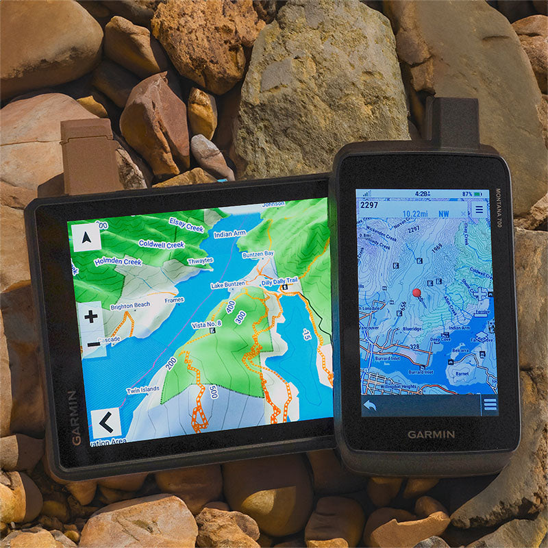
"Popped the card straight into my Garmin Rino and everything just worked."
Chargement...
Cartes GPS de l'Ontario
For Garmin GPS Units
$15000
Prix unitaire
/
Indisponible
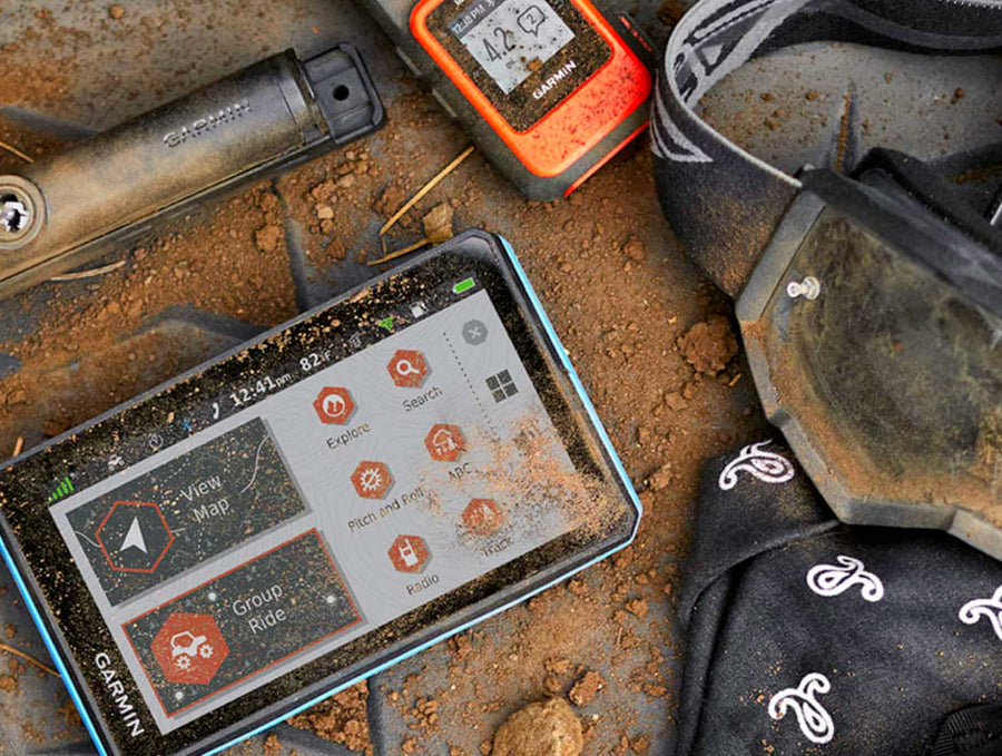
✔️ Best for: hunting, ATVing, snowmobiling, overlanding, remote fishing trips and backcountry exploring.
MicroSD Card VS Digital License
MicroSD Card VS Digital License
PLUG & PLAY MicroSD Card
- Plug & Play Installation: Simply insert the card into your Garmin GPS unit, and you're ready to go!
- Card Size: Pre Programmed on 8, 16 or 32GB microSD card. Our GPS maps occupy up to 2GB of space on the SD card.
- Coverage: Single Province or Pre Built Combo Maps
- SD Card Adapter: The maps are stored on a microSD card. The packaging includes an SD card adapter for older units.
DIGITAL LICENSE
- Immediate Installation: After your purchase, you can download the maps and install them on your device right away using Garmin Basecamp. No shipping required.
- Coverage: Customizable Maps, Build and combine maps the way you need.
- Compatible with Garmin Smartwatches: Install our maps on your new Fenix, Descent, MARQ, or other Garmin smartwatches. Check the list for compatible models.
Map Coverage and Version Summary
Map Coverage and Version Summary
Scale: Dynamic Scale
Version:
Covering these GPS Maps are the most detailed, comprehensive and up-to-date GPS maps available on the market.
BONUS App access
BONUS App access
Includes free access to the BRMB Maps smartphone App and Web Map. (limited time)

More Backroads. More Trails.More to Explore.
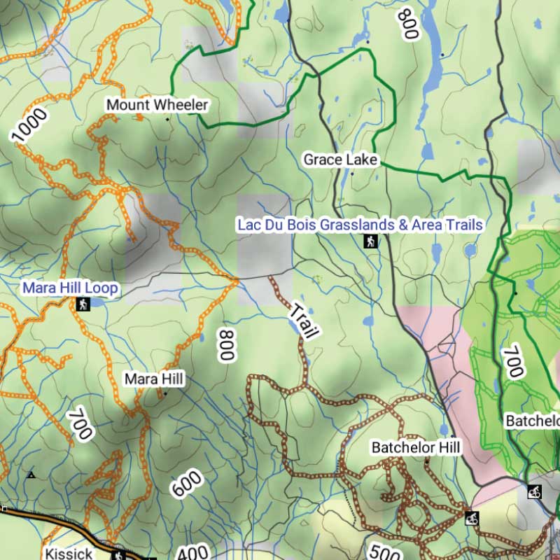
Get detailed backcountry maps for your Garmin GPS, covering areas that regular road maps miss. Explore remote backroads, ATV and snowmobile trails, hunting zones, and Crown and Private land.
Backroads & Land Information
Forest service roads, resource roads, topography, Crown and private land information.
Trails, Hunting & Recreation POI
ATV and snowmobile routes, hunting areas, fishing lakes, campsites and outdoor points of interest.
Works Offline on Compatible Garmin GPS Units
Offline maps stored on your Garmin, ready to use without cell service or phone battery concerns.
Cartes GPS de l'Ontario Features
Coverage and Versions
Included in Cartes GPS de l'Ontario V2025
Included in Cartes GPS de l'Ontario V2025
Des aventures légendaires vous attendent
Des plages et des parcs magnifiques des Grands Lacs à la forêt infinie et aux roches anciennes du Bouclier canadien de l'intérieur, en passant par la vaste étendue sauvage du Nord, l'Ontario offre un éventail éblouissant d'options aux explorateurs de plein air. Que vous pagayiez le long des rives de l'île Manitoulin, passiez la nuit sous les étoiles dans le parc provincial Algonquin ou traquiez un orignal dans le vaste arrière-pays nordique de la province, les occasions de créer des souvenirs dans la nature de l'Ontario ne manquent pas, et nos cartes GPS de l'Ontario sont votre guide ultime pour tirer le meilleur parti de votre expérience.
Cartes GPS des routes de l'arrière-pays de l'Ontario en bref:
- Combinant la navigation quotidienne avec des informations améliorées sur les loisirs de plein air, ce produit regroupe l'ensemble de l'Ontario en une seule carte GPS de l'arrière-pays, combinant nos titres de cartes de l'arrière-pays du Sud de l'Ontario, de la région des chalets de l'Ontario, du Nord-Est de l'Ontario et du Nord-Ouest de l'Ontario en un seul produit.
- Plus de 660 000 km de notre réseau de routes de l'arrière-pays combinés en une seule carte, incluant près de 310 000 km de routes navigables et plus de 34 000 km de routes secondaires ajoutées dans la version 2019.
- Zones de gestion de la faune (ZGF) marquées pour les chasseurs.
- Terres de la Couronne clairement définies pour les chasseurs, les pêcheurs et les campeurs.
- Contours bathymétriques pour près de 1 500 lacs, rivières et cours d'eau de pêche.
- Couverture du parc de la Gatineau et du sud du Québec.
- L'outil de recherche d'adresses facilite la navigation comme jamais auparavant.
- Des dizaines de milliers de kilomètres de sentiers de VTT, de pistes de motoneige, de sentiers de randonnée, de vélo et de ski de fond multi-usages et de routes de canotage, avec des points de départ de sentiers et des points d'accès/portages marqués, incluant près de 4 000 km de nouvelles routes de canotage et plus de 1 500 km de nouvelles pistes motorisées dans la version 2019.
- Des milliers de sites de pêche, de parcs et de zones de conservation, de campings, de zones de chasse, de zones de loisirs d'hiver et plus encore.
- Plus de 41 000 caractéristiques géographiques terrestres et aquatiques.
- Cartographie améliorée pour un meilleur affichage des parcs, des zones de conservation, des terres de la Couronne, des ruisseaux et des points d'intérêt d'activités.
- Lignes de pistes de motoneige améliorées, couverture des réserves des Premières Nations et bornes kilométriques des couloirs ferroviaires.
Land Information, Roads, and Trails
Land Information, Roads, and Trails
Adventure Points of Interest
Adventure Points of Interest
Backroad Extras are where you find all the POI information specific to our Backroad GPS Maps.
Map Format & Compatibility
Map Format & Compatibility
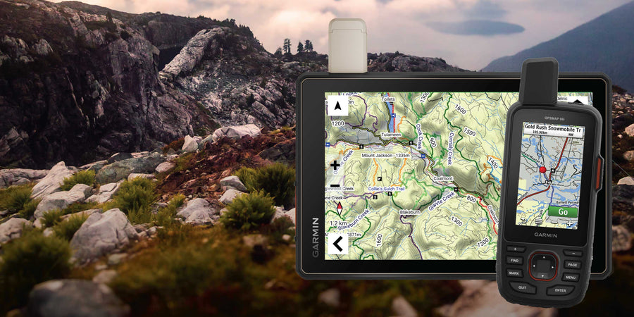
Our Backroad GPS Maps are designed to be compatible with most Garmin GPS Vehicle or Outdoor models made in 2012 and later that accept SD or Micro-SD cards.
However, it’s important to note that some units may experience issues with display or feature availability, depending on the model version.
You can check if your unit is compatible here.
Map Format
- Preloaded on an 8, 16 or 33 GB microSD card for easy installation (digital download also available)
- Seamless topographic mapping at 1:20,000 and 1:50,000 base scales
- Shaded relief and 3D views on supported Garmin devices
Overall rating: 3.6818182 / 5 from 22 reviews.
AI Generated Review Summary
Summary topics
Review topics: [].
Review highlights
Reviews
No change. . . write off.
"Couldn't see a difference, so i dont know if I did something wrong but to me was like throwing money straight into trash can."
Missing
"I live in the North (Cochrane). Just like your back roads book. It needs to be updated, roads that are ten years old are not on the backwoods, and roads that are no longer there, still show as active. Needs a overhaul. The book is even worse, I bought the 4th edition, and recently bought the 6th edition. Nothing changed except the advertising. Missing roads, showing roads that are not there. Not impressed"
Great
"Great"
Not user friendly
"Very difficult an untuitive install process for digital map on Garmin Zumo XT2 GPS. I paid 150$ and still doesn't do what I needed, which was to show me clearly unpaved roads, so if you want to buy for this purpose for motorcycle, then look elsewhere."
Downloading of map is confusing
"Difficult (impossible) to do with an IPAD. Need computer. Instructions found were inscrutable and had to ask the ai search engines to produce instructions."
Many trails missing
"My new prayer of mission in WMU 25. . They at least three years old, but do not exist there on back road maps"
Using it in my Garmin
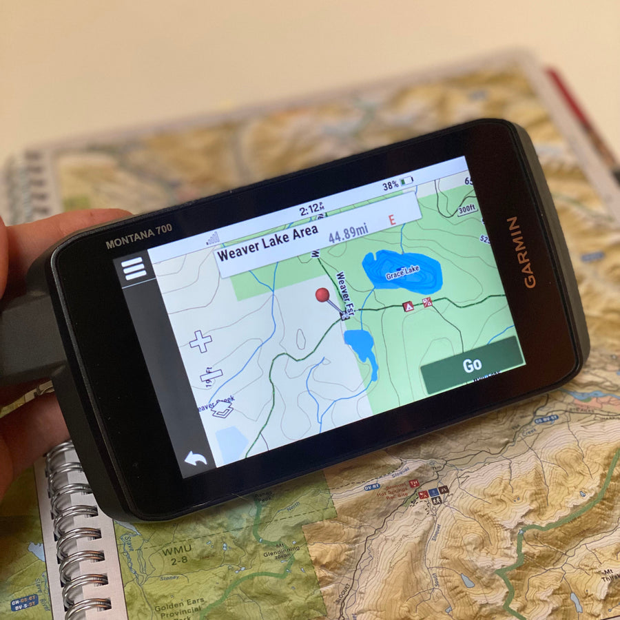
"Using it in my Garmin Montana for hunting and clearly shows, private & crown land and atv trails, swamps and etc!!"
Reliable but not 100% up-to-date
"not 100% up-to-date, but that's impossible to expect. An update once in a while could deal with that, not sure if that is available."
its good not sure if
"its good not sure if latest satelite pics"
Q&A
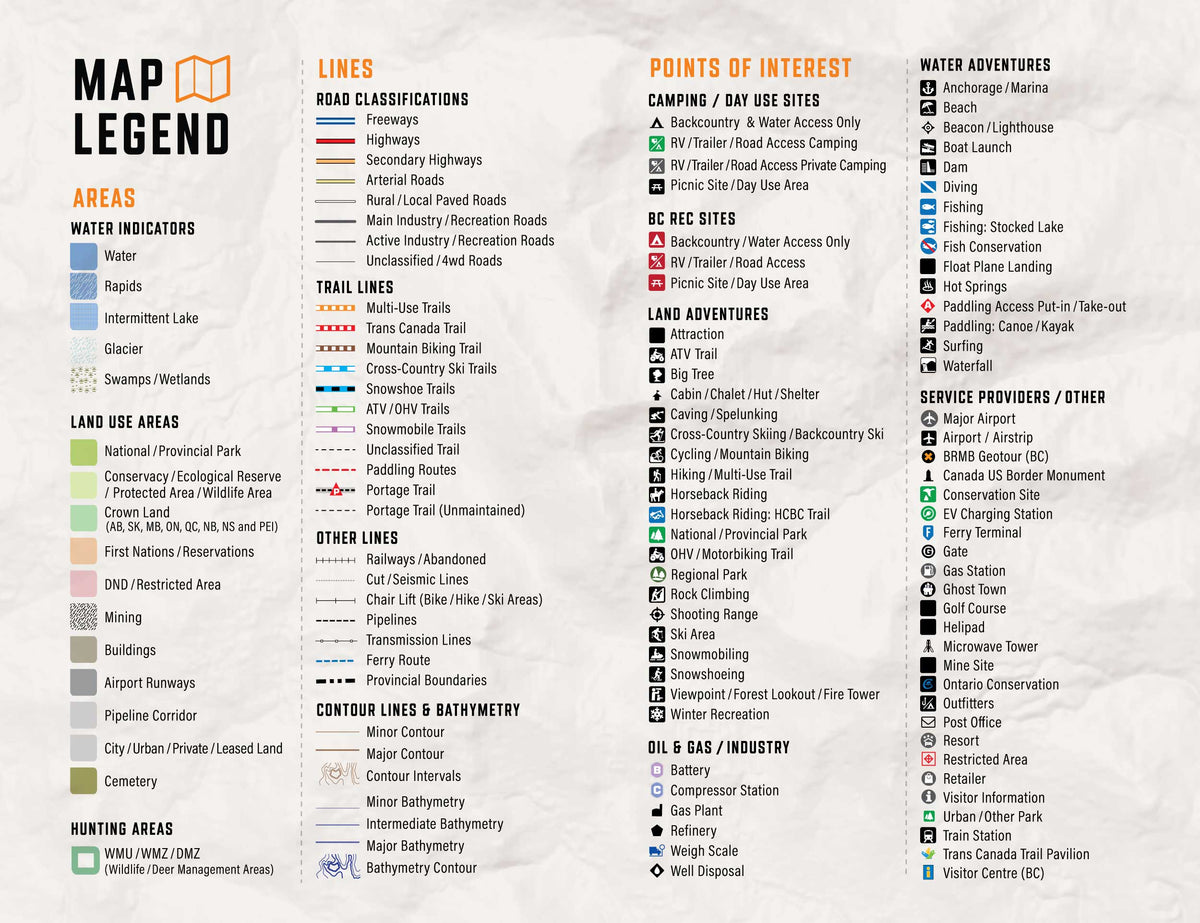
- How do we access the legend as shown on this page on a Garmin device?
- The legend is printed on the GPS Maps packaging
GPS Maps Guides
Showing articles tagged “How to Guides”